Wednesday, September 20, 2006

Virtues Of The iPod

Now that I have talked about one of the devices (my GPS navigator) that make life on the road tolerable, I would like to mention another, the Apple iPod.

I was initially exposed to this little white box during a camping trip to Iowa. John, my technological friend, who knows a lot about cameras and other gadgets, pulled his out and started explaining what it does. (This harkens back to the days when we were comparing notes on our Apple Newtons, which I still adore.)

As with all new technology, the iPod didn't seem like a very big deal when it first made an appearance. "Yeah, it plays music", I thought. "So what?" I've got several Sony products that play cassettes and compact discs, plus a radio that works just fine.

Of course, it dawned on me while driving back home that I had a pile of cassettes and CDs floating around in the car. These were pretty bulky and inconvenience to handle. Also, my CD player was susceptible to bumps on the highway, always skipping when I went over a bridge, for example. I often had to set it on a towel.

As for cassettes, I had given up on music a long time ago. All my cassettes, now, were of audio books. These made long driving trips quite enjoyable.

The car radio had its problems. There was always the fact that stations would come in and out of reach as I would cruise from town to town. Almost as annoying was the selection, consisting mostly of Christian broadcasting, public radio, rap/hip-hop, country and western, and overplayed classic rock. None of these choices provided enjoyment for very long.

The idea of the iPod, or any digital music player, began to grow on me. If I could learn how to use one, I might be able to get rid of all my media clutter. No CDs or cassettes to fumble with, or potentially damage or misplace. Everything would be organized in one neat package, the unit's tiny hard drive.

Some time later, I was reintroduced to another person's iPod and discovered its shuffling feature. This is what finally sold me. I could put all my favorite music on this compact electronic player and it would randomly play selections. It was like the best radio station you could imagine. Without commercials, you would hear only the music you wanted to hear, and always be surprised.

So, I bought one. Shortly thereafter, I decided it was one of the best things I had ever bought in my life. At least in the top 5. It was extremely convenient and practical. Easy to use. No mess. Everything you want. Nothing you don't.

Once you own an iPod, you have to find things to place in it. At the time I purchased my unit, Pepsi was having an iPod promotion. You could look under the cap for a code, which you would then enter at Apple's iTunes Music Store. This would allow you to download one free song of your choosing. I got my first 50 songs this way.

Next, using the iTunes software on my computer, I began to convert all of my compact discs to mp3 files. Once in this format, songs could be easily transferred to the iPod's memory bank. Having done this, I was happy as a clam. I could ride around for hours and hear all of my albums, played in random order, with no repeats. I could also use the iPod's menu to narrow the playlist to include specific artists and genres.

As digital music players became more popular, additional forms of entertainment became available. Soon, audio books appeared on the web. At audible.com, I was able to purchase and download a number of books to my liking.

Most recently, so-called "podcasts" have become all the rage. These are digital audio and video segments that come from a variety of producers, both big and small. Again, I have gotten a number of these, for free, from the podcast section of the Apple iTunes Music Store. Other sources, such as Podcast Alley, are popping up as digital media distribution centers.

Podcasts are highly targeted forms of information. Many have to do with specific personal interests and hobbies. I personally enjoy ones on science and higher education. You can also find ones that discuss travel destinations, politics, health maintenance, and learning new languages. All sorts of stuff. Many radio and television programs are likewise being turned into audio podcast files.

I, myself, tend to travel alone. In such cases I would not recommend the iPod's new video capabilities, since they would be distracting. If you are traveling with a family, or other group, however, this might be just the thing. Both movies and popular television programs are available in the iPod format for a modest price.

Let me reiterate. Digital music players are a totally convenient way to store, organize and access music. They have the capability to hold and display a wide variety of content. The only hurdle these items have to overcome is the playback system.

If you are in a car, you are mostly limited to using an FM transmitter, one that will broadcast the sounds on your iPod to the car's radio. These often have difficulties, depending on the matchup between the transmitter and the car's radio receiver. I happen to drive a lot of rental cars and each one seems to have a unique personality regarding the radio system. Sometimes my iPod will play flawlessly. At other times, the signal is very intermittant. In the worst situations, listening can be quite frustrating. In the future, though, I see a trend to incorporate direct inputs for digital music players. This would eliminate the headaches.

Overall, my sleek little iPod has been my faithful traveling companion, eliminating everything I don't like about music on the road. I start my car, plug in the player and drive blissfully for the next 6 to 10 hours. What could be better?

Saturday, September 16, 2006

Glaciers

Without doubt, the most impressive things I saw on my recent trip to Alaska were the glaciers.

Prior to this, I had never seen one, at least not in person. I have a few old pictures of my uncle visiting a glacier when took a motorcycle tour of Banff and Jasper National Parks in the late 1940's. It looked pretty frosty. When I finally saw one for myself, pictures could not describe the impression it left on me.


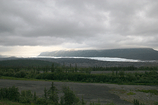
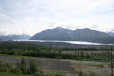
Coming into Alaska on Highway 1, I passed a number of spectacular mountain peaks as the highway slowly rose in elevation and leveled off. Roughly 50 miles from Palmer, the grade began to descend. On my way down I caught sight of a curious feature.


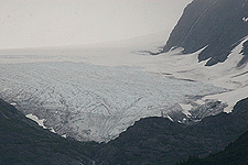
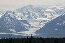
Along the side of a mountain range was a river of ice. The scene looked as though someone had spilt some milk and it was following the path of least resistance. It hardly appeared substantial at all. From a distant side view, the phenomenon came across like a white ribbon that curved its way back between the peaks.


Then a sense of scale set in. I was observing a mountain. A huge one. The snowy band at its base must be tens of miles in length, with significant width and depth. It had to be. This was my first glacier and it was glorious.


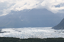
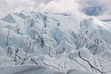
Continuing my drive, I eventually came to a scenic turnoff that included a viewing platform. I was still at a great distance, but had now passed the end of the field. Reoriented, the glacier was flowing towards me. I took out my camera and attached the telephoto lens. The terminus of the ice sheet looked very peculiar. The surface gave the appearance a tooth. Its irregular edge undulated like a crashing wave at the beach. The body behind rippled into the vast distance beyond. This was the Matanuska Glacier.


I only had a couple of minutes to take in this natural wonder, then it was off again to Palmer. During my assignment, the builder I was shooting for advised me to visit the Portage Glacier if I found 2 or 3 hours to kill. On Sunday, that is just what I did. Driving South, through Anchorage, I skirted the edge of the Kenai Peninsula and Cook Inlet until I reached Chugach State Park. A sign pointed the way to the Portage Glacier and there I went.


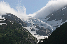
Having never seen the Portage Glacier, I was unsure of what to be on the lookout for. In the distance, nestled between two crests was a formidible sheet of descending ice. Surely that must be it. I got as close as I could and pulled into a parking lot next to an observation area. The scene was quite beautiful. A craggy cake of turquoise ice was perched between two rocky peaks. White clouds flowed over and into the depression, caressing the ice as it went by. Framing this was a vivid blue sky, green babbling brook and hearty evergreens as far as the eye could see.


Somehow, though, the scene did not seem worth all the buildup. Yes, it was pretty, but there was an awfully lot of snow residing between the mountaintops most everywhere. I didn't see what might make this an exception. Just in case, I got in the car and drove further down the road. Then I came to a sign saying "Portage Glacier Ahead". Well, I felt kind of silly after taking so many pictures of something else, but was glad to have finally stumbled across the genuine article.


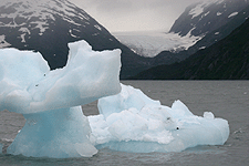
The road deposited me into a parking lot in front of a small lake. Floating tranquilly were two aqua-colored icebergs each the size of a truck. Off in the overcast distance was a massive bed of grey ice, creeping towards the water's edge. It had the character of something that had been around for a very long time. It was cracked and dingy. Spectators were gathering at the lip of the lake to have their images taken with the glacier in the background. Here, the air was actually cold. Not only did people need sweatshirts, but jackets as well. Someone in the group informed me that this body of ice, like many others, was receding. It had been much more prominent in the past. This was not too difficult to spot.


It would have been nice to have gotten closer to this frozen giant, but that would have required one of the available boat tours, for which I did not have the time. Therefore, it was back to Palmer. The next day, I finished my work and was ready to depart. Forced to exit Alaska the same way I entered, I was presented with one last opportunity to experience Matanuska.


The Matanuska glacier does have public access. Tailing a happy couple in a car to the gate, I signed the safety waiver and followed them to the staging area. As one would guess, walking on a glacier can be pretty hazardous. Any number of bad, unexpected things can occur. This did not stop a moderate contingent of inquisitive souls from taking a stroll on the ice.


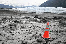
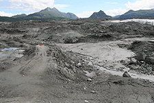
It took about 15 minutes to walk from the parking lot to the leading edge of the ice. During this process, one learns a few fascinating things about glaciers. First, park managers set up a path for explorers to follow using orange safety cones. Even though you can see the land between yourself and the glacier rather clearly, this precaution is to keep you from getting stuck in the dense grey mud.


Following the trail, the ground is a bit rough, but nothing a normal person couldn't handle. As you progress you notice that the ground does indeed get soggy. This is from all the liquid runoff the melting glacier is producing, or perhaps the surrounding snow. In either case, little streams of water were flowing in numerous places.


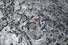
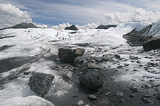
Before long I noticed a transition in the ground's texture. I looked down to see a collection of small angular rocks imbedded in solid blue ice. It was extremely hard, dense and heavy. Not so much like metal, which has a degree of flexibility, but more like acrylic or crystal.


Next came the sound of a light crunching as I moved on to the snow. Like the crackling sound a bowl of cereal makes when you crush the flakes with a spoon. I could feel the surface mash down just a little when I walked on it. Also, the temperature began to get cold. Whereas I was warm before, I now needed a sweatshirt to be comfortable.


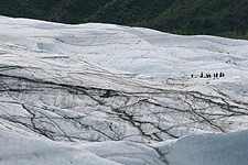
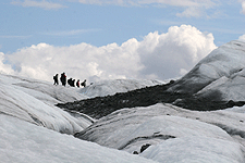
Eventually I reached the bounding heaps of ice. These got progressively larger as the glacier moved on into the distance. Traversing the ice sheet, for me, was problematic. I was wearing tennis shoes. Other visitors, who had brought shoe cleats and ice picks were nimbly hiking the major masses of the pack. I was only going to be able to get so far. The trick was to stay on the dirty areas, where tiny pebbles were stuck in the snow. These could be walked on. Finding a direct path of them from point A to point B was not necessarily easy.


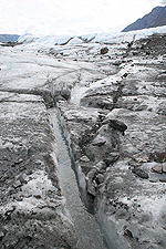
With extreme caution, I climbed onto the lesser domes of the ice. In the valleys, lengthy fractures had formed and these had water flowing through them. Since I was forced to walk in the low areas, getting wet or muddy was always a potential difficulty. At one point, I found a flat area of dirt and rocks that seemed favorable. This turned out to be mostly mud with a slightly dry surface. Glop, glop I went.


Ultimately, I topped the crest of one of the minor mounds and stopped to survey the enormous body of the glacier that spread out before me. I knew I would not be able to go further, up ahead where many other tourists were marching. For me, this was good enough. I was standing on a glacier and it was totally thrilling, more so than any other place I had been.


How can I describe what I saw? It was spectacular. It was big. it was white. it was lumpy. It was powerful. It was serene. It had cracks criss-crossing it. Clusters of chilly people were wandering all over it. It was like an ice maker dumped out several trillion ice cubes in a very long pile. You were dwarfed by it, like an insect is dwarfed by a freeway. It's just hard to believe that it even exists and that you are touching it. It was beautiful. It makes your heart race.


Continuing down the other side of the slippery slope, I discovered a dry, rocky area that circled back to the glacier's edge. I should point out that around the leading edge of the glacier, sharp-edged rocks of all sizes could be found just setting there. Most of them looked as though they had been shattered, no doubt by the tremendous pressure they encountered in the ice during their long journey to this place.


Heading back to the car, a revelation occured to me. As I left the swollen heaps of shiny white ice and navigated the frozen, blue, rock-saturated ground, I realized that I was still on the glacier. It did not simply begin where the lumpy mounds appeared. It was deep beneath my feet. Here, the top frosty layer had been melted away, leaving the rest to be covered over by dirt. Who knows how far beyond the visible edge the glacier actually extended. This is what a glacier goes through in recession.


It was sad to say goodbye to the Matanuska Glacier, I wish I could have stayed longer to explore. My brief encounter was both exhilarating and informative. I hope I have the chance to see another. I hope you do too.

Friday, September 15, 2006

The Midnight Sun

This is just a side note talking about what it's like to be in Alaska during the Summer.

As most people have heard, being up in the higher latitudes causes the day-to-night ratio to become pretty extreme. I happened to be in Canada and Alaska during the first part of July, right after the longest day of the year took place. In Alaska, as opposed to say, Kansas, the term "longest day" had significant meaning.

The further North I drove, the longer the daylight lasted. This had the effect of letting me travel long distances without having to worry about the daylight running out. Basically I stopped due to being tired, not because it was after dark.

Most often, when I am driving in the lower 48 states, I tend to stop between 6:00 and 7:00 because that's when the hotels start to fill up. This was unnecessary in Canada. Also, driving at night on the Alaska Highway can be incredibly dangerous due to the randomly placed wildlife. This, too, was overcome with the extended daylight hours.

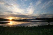
Arriving at Palmer, Alaska, I discovered that the sun hit the horizon shortly after Midnight, around 12:30 am. One evening, I peaked my head out the window close to 3:30 am and the sky had brightened back up. For all practical purposes, the sun never set. This allowed me to get an immense amount of work done.


Being a real estate photographer, I am very conscious of where the sun is in the sky. Often I have to scramble to shoot all of the East facing houses on my list between 10:00 and Noon and then shoot all of the West facing homes between 2:00 and 4:00. In Alaska I could take my time. Since the sun moved at a snail's pace, I could get up at most any reasonable morning hour and complete my first set of photos with minutes to spare. Next, there was nothing to do but take an extended lunch. Resuming my assignment, I could work as late as 6:00 or even 8:00. Following that, there was still time remaining to go explore the surrounding countryside. I didn't ask anyone, but I suppose that the Alaskans have adapted to an equally relaxing pace.

Upon returning, a number of friends asked me if the constant daylight kept me from sleeping, or if the lack of evening made me tired. The answer was a definite "No". The ever-present daylight kept me energized from the time I woke up to the time I went back to sleep. The only reason I actually went to sleep was because I looked at the clock. Once indoors, I simply pulled the blinds and nodding off was not a problem.

The long daylight hours had an interesting effect on the temperature. It barely fluctuated. People back home (where it was 104 degrees) asked me if it got cold at night. No. There was no "night". With the sun always out, warming the air, the temperature hardly dropped, even at "twilight". I don't know if this was normal, but the climate was relatively mild and comfortable. The only time I felt cold at all, was when I approached a glacial ice pack.

Yes, Summer conditions in Alaska were perfect for lovers of the Great Outdoors, especially golfers. There seemed to be an abundance of golf courses and people could play to their heart's content. Whatever a person might choose to do outside, there was never any rush to finish. For nocturnal critters, however, the Midnight Sun did pose a few problems.


Now, for a moment, let's imagine what it's like in Alaska in January. I'm guessing there are only three hours of daylight, if you can even call the sun barely being above the horizon "daylight". This has to explain the high density of "expresso huts" I encountered. They were everywhere. I bet in Winter they do a brisk business. So what is life like when there are 21 hours of darkness? It must drive citizens nearly insane. I hear that it's cold, but it doesn't snow much. And they tell me the tour guides all go to Hawaii.


The one thing I did miss by being in NorthWest in the Summer was the Aurora Borealis. Perhaps it is the one consolation gift the locals receive during their long hibernation. I wish I could have witnessed the Northern Lights, but they were temporarily blotted out by the light of the Sun.

Thursday, September 14, 2006

Driving To Alaska - part 2

Now that I have covered some of the logistical aspects of driving to Alaska, I will tell you what I saw.

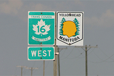
I began by driving North up Highway 75 towards Winnepeg. Skirting Winnepeg, I briefly took Highway 1 West, until I connected with Highway 16, the so-called "Yellowhead Highway".


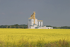
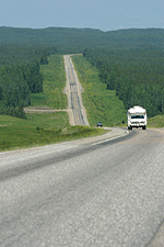
For several days I traversed the Yellowhead Highway, taking it from Winnipeg, Manitoba, through Saskatchewan, to Edmonton, Alberta. On either side of this route was farmland, punctuated by a repeating series of grain elevators. Not much else. If I didn't know better, I would have sworn I was in Iowa or Nebraska. Of course, I was traveling right over Nebraska, so the landscape looked the same. This took me back a little because I thought things might look a bit different in a foreign country. They didn't. This was part of coming to terms with my misconceptions.


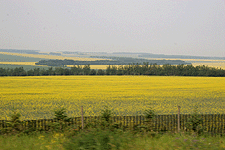
Now, the flip side of my damaged expectations was that I expected the farmers to be growing corn and soybeans and wheat . They weren't. They were growing canola. Vast stretches of lower Canadian farmland were colored a bright dazzling yellow. I didn't know what this was at first, and it certainly was eerie. Later, after seeing a billboard and having talked to a filling station attendant, did I learn what this omnipresent crop was.


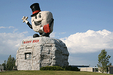
All rural landscapes are dotted with tiny farming communities, and Canada was no exception. The amusing thing was that many of these towns had an iconic mascot. In Gladstone, I was greeted by "Happy Rock", a smiling nugget who was affectionately waving. At Beaver Lodge, there was a giant concrete beaver. Following that, there were oversized ducks and bears and lumber jacks. It really showed you how laid back and fun-loving Canadian citizens are. In fact, every person I encountered in Canada was exceedingly nice, friendly and helpful. A great lot, they were.


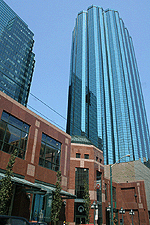
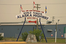
Reaching Edmonton, I stopped for a few moments to inspect a major Canadian city. It seemed to be very modern and culturally complex. Evidently, in places, Canada is very sophisticated. Well, how can anyone not know that? Moving along, I turned North, up Highway 43, until I reached Dawson Creek, British Columbia the official starting point of the famous "Alaska Highway".


In Dawson Creek, there is a prominent sign stating that you are at "Mile 0" on the Alaska Highway. I found it interesting that even though Canada uses the metric system, landmarks along the Alaska Highway are called out in miles.


Anyway, I set out on this 1390-mile long, two lane road and immediately started to notice changes in the scenery. The flat crop-laden fields along the Yellowhead Highway had transformed into rolling hills, covered with evergreens. Their piney scent permeated the air. Also in the air was smoke from a number of nearby forest fires. This gave the atmosphere a distinct yellow cast and was quite unnerving to drive through over a long period of time. In some areas, the fog was dense enough to obscure the horizon. I was told later, that several nearby towns had been forced to evacuate.


Over time, British Columbia grew more mountainous, which caused the roads to become increasingly angular and twisted. One particular stretch, between Summit Lake and Muncho Lake, yielded an abundance of wildlife. Prior to this, signs were beginning to appear warning drivers to be on the lookout for moose and sheep. It wasn't very long before these predictions came true. Rounding a curve, a family of bighorn sheep appeared before me, three males, two females and a baby. A couple of cars had pulled off the side of the road and were quietly observing them. I joined the fascinated onlookers for a couple of moments.


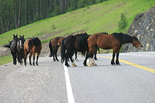
North of Muncho Lake, where I camped for the night, were new signs alerting the presence of wild horses and buffalo. Sure enough, several miles beyond, were packs of animals casually wandering down one lane of the highway, with automobiles creeping along behind. Like the sheep, the buffalo were shaggy in appearance, abandoning their thick Winter coats. The thing that made the horses stand out were their exaggerated muscularity.


And then there were the bears. Over the course of my trek, I saw three young bears along the road. Before leaving on my assignment, almost everyone advised me to be on my guard for these furry creatures. I certainly tried to put myself in a position where I would never encounter one. While looking over a potential campsite one evening, I noticed a large sign detailing what a person should do if they were to come face-to-face with a wild bear. It was divided into 7 sections, each devoted to a specific type of bear situation. That was being more prepared that I cared to be, so I went to a more populated campsite and surrounded myself with a protective layer of other campers, which a hungry bear might choose to eat first.


The animals that did manage to eat me alive were mosquitoes. God, they were awful. The minute you went near the grass they would swarm. It wasn't long before I learned to cover as much of my body as possible with clothing and then spray the exposed skin with repellant. Folks had commented on the mosquito problem early on, saying they were worst in Alaska. Alaska, wasn't bad, however. The true culprits were British Columbia and the Yukon. I fantasized about the mosquito being one of these Province's official bird. That was until other travelers started repeating the idea back to me.

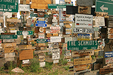
At the edge of the Yukon border I was surprised by an unanticipated treat. Watson Lake, a milepost community, contained an oddly unique, yet well-know attraction, called the "Signpost Forest". This was an area about half the size of a city block, containing hundreds of tall, upright posts. Nailed to every pole were about a dozen signs, each displaying the name of a city or family. Starting with a single individual, this phenomenon has grown continually over the years, reaching epic proportions. People now come from all over the world, just to leave their mark at this famous crossroads.


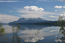
Building on British Columbia's natural beauty, the Yukon Territories were ever more picturesque. I especially enjoyed the drive along a large body of water known as Kluane Lake and an inlet named Destruction Bay, with its aquamarine waters. On the opposite side of the highway was Kluane National Park and Perserve, which flaunted several rugged, snow-capped mountain tops. This was just a taste of what was to come.


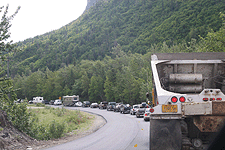
It was on this stretch of the Alaska Highway that reports of weather-related road damage came true. Yes, the closer to Alaska one got, the more wavy and distressed the roads became. It was a bit of a rollercoaster ride in places, causing traffic to slow down considerably. What was more distressing, though, were the intermittant sections of roads that were being repaved. On at least five occasions, I sat in a long line of vehicles waiting to go down a single lane of the thoroughfare.


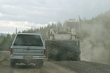
Frequently, sections of road which were under rehab had been reduced to gravel, perhaps 1 to 5 miles at a whack. Fortunately the pace car leading us never exceeded 30 mph, so no damage was done. Afterward, you would find yourself whizzing down a perfectly smooth, newly paved section of road. That part was great.


But the greatest part was the Alaska scenery. It was simply breath-taking. British Columbia and the Yukon had served merely as a prelude to Alaska's heavenly majesty. The mountain ranges, glaciers and dramatic weather produced an awesome sight. Thank goodness that road planners had seen fit to place turnoffs along the highway at frequent intervals. I stopped to take advantage of a number of these.


To visit Palmer, AK, my end destination, I departed the Alaska Highway near Tetlin Junction. My new route was Highway 1, also known as the Tok Cutoff. This took me past some remarkable scenery, including the Matanuska Glacier, which I will mention in a future entry.


Both entering and leaving Alaska were an easy proposition. I barely remember doing either. Returning to America had some distinct advantages. First you have to realize that there is basically only one road into or out of Alaska. So if you are returning the same way you came in, you are forced to see everything twice. What a fantastic opportunity. On my way back home, I was not quite in such a hurry and this allowed me to savor many of the landmarks I had rushed by before.


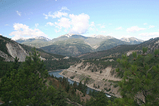
Eventually, I made my way back to Mile 0 of the Alaska Highway at Dawson Creek, where I took a new path that would lead me to Seattle. This route, primarily Highway 97, finished taking me from one end of British Columbia to the other. As I drove South, I noticed several distinct geographic regions. In central British Columbia, the land was red and covered with sagebrush. Like Nevada, it's terrain was smoother, with gently rolling hills. Lower BC resembled Colorado. There were moderately high peaks above the road and roaring, winding rivers below. The highway snaked its way along the edge of all this in the middle.


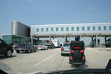
After 15 days of driving in and around Canada and Alaska, I re-entered the United States at Sumas, Washington. My eagerly-waiting friend, Gary told me there might be a multi-hour wait to cross the border. Yes, there was indeed a long line, but I think I made it to the gate in just under 60 minutes. Once there, I had no difficulties in crossing the border. Several vehicles with Canadian license plates were not quite so lucky.

Driving To Alaska - part 1

In doing research for my Alaska road trip I got a lot of information from both freinds and the Internet.

I discovered several websites that were devoted to driving the lengthy Alaska Highway through Canada. Some of these involved stories of a personal nature, while others were a bit more formal and systematic. From these I learned about the individual routes one might take through Canada towards Alaska, plus the scenes and conditions I might encounter. Most web accounts made it seem like a journey up North would be no big deal, providing your were cautious and well-prepared.

Details gathered from personal friends and acquaintances were a bit more worrisome. I can only conclude (after the fact) that the information they gave me was somewhat out-of-date. Mostly there were descriptions of long sections of unpaved roads, where loose chat would destroy your headlights and windsheild. Road conditions would also play havoc on your tires and ding up the car body. The individuals reporting these facts to me often asked if a drive to Alaska was something I was certain I wanted to attempt.

Friends also told me about how the changes in seasonal temperature cause the ground beneath the highway to swell and contract, leaving the surface of the road broken and distorted. There was some truth to this, I discovered. The same folks said I should be prepared to entertain myself for long periods, because I might be the only car on the highway for hours at a time.


Well, I have to say that overall, my jaunt through the Northern wilderness was quite pleasant and uneventful. There were some surprises, but these had mostly to do with my expectations.

Upon entering Canada on Interstate 29, above Fargo, ND, I had no problem getting in. I simply showed the official my passport and told him the purpose of my trip. He asked me some typical questions about whether I was transporting any unauthorized items, or if I would be returning with any Canadian purchases. Evidently satisfied, they let me pass on through into Manitoba. Of course, I do suspect that I and my vehicle were covertly scrutinized through the use of cameras, detectors and information technology. If so, it was a painless experience.


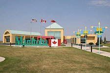
The next hurdle to get over was money. Having never left the United States before, I had no idea how dealing with foreign currency would work out. Immediately after passing through border security, I came upon the Manitoba welcome center. Here, I was greeted by several cheerful and attractive ladies, who proceeded to orient me to their country. They provided me with volumes of helpful literature and directed me towards the currency exchange booth.


Again, the lady at the currency booth was quite charming and astute. She neatly took my bland American cash and converted it into the equivilent amount of Canadian bills and coins. I do have to say that their money is quite beautiful. I guess I arrived in Canada at a good moment, because the exchange rate was almost even. This kept me from worrying about how much I was really spending as I went. And to my delight, they had the same basic denominations that we use here, with the exception of the single dollar, which is a coin, not a bill. It's called the "loonie". It has the picture of a loon on it.

My strategy for carrying money in Canada was to hedge my bets. I would keep about half my available funds in cash and leave the rest in my checking account, where I could access it with my ATM card. Although I was going to try to use my bank card as much as possible, it does have a history of not working at the most inconvenient of times. Therefore, I decided to be prudent. In fact, I wasn't sure if the card would work at all or if it would be accepted out in the wilderness. As it turned out, practically everyone was willing to take plastic. And transactions went through about 3 out of every 4 times. When I was declined, my pocketful of cash saved me.

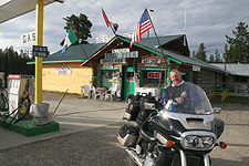
My next challenge was to come to terms with finding fuel. One piece of advice I took to heart was to "treat every gas station like it's the last". This I did. Gas stations were few and far between, but came often enough to keep travelers from being in a state of panic. Sometimes, though, gas stations would be closed or had run out of fuel. This lead at times to a little anxiety. As I traveled, I stopped to fill up at virtually every gas station I came to, even if it only meant putting in two dollars.


It was hard to determine just how much I was spending on gas. Everything was sold by the liter. Gas prices tend to be higher in Canada, and I happened to be there when overall fuel prices were above normal. One filling station attendant commented that I was lucky to be driving a small economy car. He said that he had filled up a large RV earlier in the day for just under $400.


After traveling a few days, it became clear that I should fuel up right before I stopped for the night. I tended to depart extremely early in the morning, and service stations never seemed to open until around 9 or 10. While making my trip, I needed to cover as much distance as I could over the course of each day, at least 600 miles. I did this by staying on Central Standard Time as I passed through other time zones and by taking advantage of ever-increasing length of day.


I did find that I was unprepared for one aspect of Canadian gas purchasing. FULL SERVICE. Here in the US, we have grown accustomed to doing everything at the pump ourselves. No so in Canada. The moment I pulled into a Canadian gas station a perky young lad or friendly old gentleman would stroll over to my car and start filling it up. I was perplexed at first, but eventually adjusted.

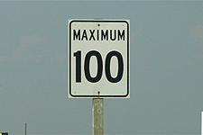
Alright. Next I will mention the speed limit and distance conventions. Everything is in kilometers, and these basically line up with the speeds we expect to travel at in America. 55 mph is 90 kph. 70 mph is 110 kph. You just have to keep track of which guage on your speedometer you are using. Otherwise, everything else seems normal. As for distances, the numbers are much larger. Traffic signs tend to be very generic and some are in French.


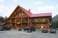
The next problem was in locating a place to stay. Now this is where reality most strayed from my expectations. Normally, as I cruise around the United States, I find there are small, inexpensive motels everywhere. I usually stay at a Days Inn, Super 8 or Motel 6. Those kinds of places. And I pretty much assumed the same would be true for the Canadian towns I was going to pass through. Uh-uh. There was a reason the girl at the Manitoba welcome center wanted to know if I was interested in camping, and subsequently handed me a thick directory. Motels were practically non-existent. At least down the roads I went on. There was the occasional lodge, but these were scarce.


What I did encounter were an abundance of Provincial parks and RV campgrounds. If I had not had the foresight to bring along a tent, I would have been forced to sleep in my car. I only happened to take my camping equipment on a whim, so I was really lucky. As it turned out, I had no choice but to camp out the whole time I was in Canada. The good news is that it was cheap. Between $12 and $20 per night. With showers and electricity.


Actually, the electricity part was pretty funny. On a trip like this, I was taking digital pictures fast and furious and needed to download them at the end of every day. I happened to have my computer with me, just for this purpose, and it was amusing to see the wires running out of my car window, attached to an RV electrical pole.

Finally, I will mention food. This, too was hard to come by. Good food only was available when I passed through a Provincial capitol, like Edmonton, Alberta. About once a day, I encountered a rural town large enough to support a fast food restaurant or two. Mostly, however, the meals I downed came from grocery stores and gas stations. One day, I could find nothing but potato chips to eat. It was rather pathetic.

OK, that's it for now. Next time, more on driving through Canada and Alaska itself.